Take a photo of a map at a Theme park or University, or while traveling abroad, and turn it into a GPS navigable map! Mark waypoints and record trails on any map you download or scan. Maps automatically align themselves to North. Great for Topographical maps. Works without network coverage.
Hi everybody! I haven't posted to my blog here because I've recently started a business called UtahAerials. www.utahaerials.com Click here for details: Kickstarter campaign My friend Scott once said to me that if he hadn't heard from me in a while, he'd get excited because he knew I was building something cool. I hope you'll agree. This is the MAXrotor. It's been close to a year in the making, but I think it's been worth it. It combines all I've learned into one aircraft. It's primary aim is to be durable, easy to build, fly, repair, and upgrade.
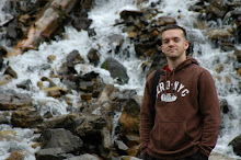
I'm currently studying Psychology at the University of Utah and working as a rock climbing instructor. In my spare time I love to snowboard, rock climb, program, take photographs, hiking and hanging out with my beautiful wife Karalee.
I'm currently studying Psychology at the University of Utah and working as a rock climbing instructor. In my spare time I love to snowboard, rock climb, program, take photographs and hang out with my beautiful wife Karalee.